Otangaroa Conservation Area
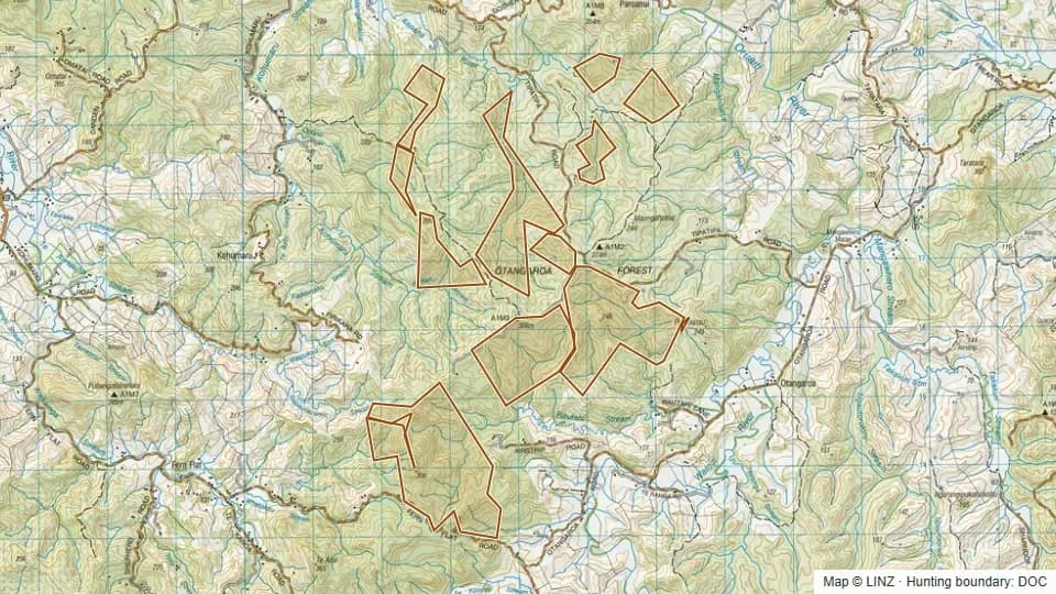
Otangaroa Conservation Area is an 874 ha block in central Northland. Elevations run from 55 m up to 303 m with a median of 183 m, putting the whole block in lowland to foothill bush below the bushline.
Aspect is broadly spread, with notable shares facing east, south-west, south-east and west — no single dominant face. The block carries subtropical regenerating bush typical of inland Northland hill country.
Open Otangaroa Conservation Area on the interactive map
Boundary, huts, terrain, tracks and 1080 zones — all layers, one map.
Terrain & elevation
Based on a sample of 2,208 DEM points inside the block.
- Elevation range
- 55–303 m
- Median elevation
- 183 m
- Middle 50%
- 151–216 m
- Above bushline (1,200 m)
- 0%
- Alpine (1,500 m+)
- 0%
- Dominant aspect
- east-facing
55–303 m, lowland / foothill country, leaning east-facing.
What you can hunt here
Access & getting there
Air access is permitted on the block. There are no DOC huts or campsites listed inside Otangaroa, so plan on day trips or fly-camp.
Permits & rules
You need a DOC hunting permit to hunt this block. It is classed as a Ordinary block in the Northland reserves permit area, with a hunting status of Permitted.
This block sits within a DOC air-access zone — fly-in hunting and helicopter drop-offs may be permitted.
A DOC hunting permit is required through the Northland reserves permit area. The block is Ordinary with Permitted hunt status.
1080 & pesticide status
No laid, planned or proposed pesticide operations intersected this block in our data. Always confirm with DOC before taking a dog in.
Data snapshot: 26 May 2026 — always reconfirm with DOC before relying on this.
Get roar & 1080 alerts for the areas you hunt
We'll email you when pesticide operations, ballot dates or access conditions change for Northland.
Sign up →