Mangakahia Forest
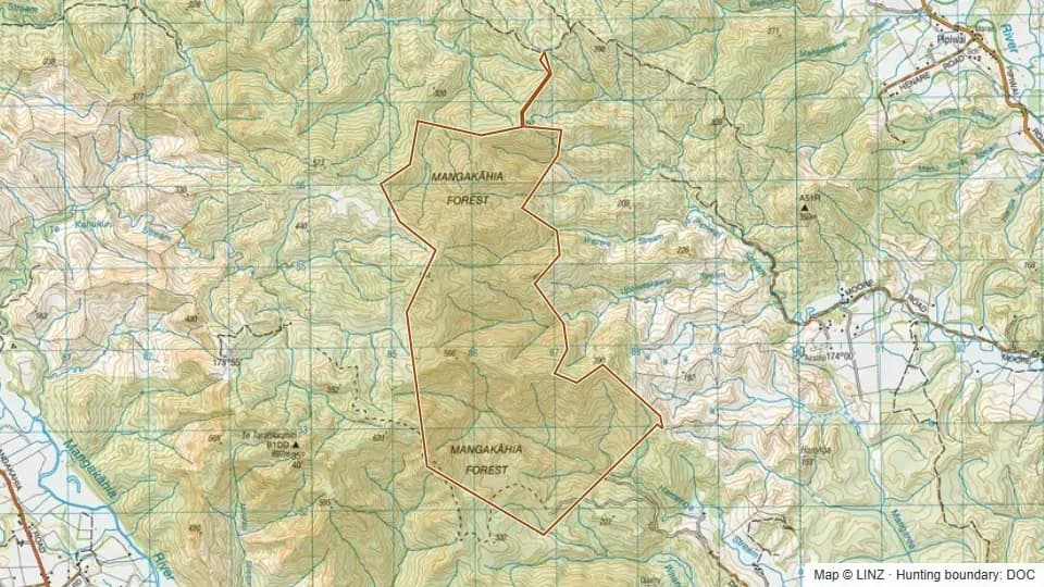
Mangakahia Forest is a 915 ha block in central Northland. Elevations run from 84 m up to 584 m with a median of 337 m, sitting in foothill bush well below the bushline.
Aspect leans south, with significant shares also facing east and north-east. The block carries subtropical regenerating bush typical of the Mangakahia inland hill country, with broadleaf cover spreading across gully systems and ridge faces.
Game on the permit is wild goat and wild pig, giving hunters a mixed-species option in a mid-sized block.
Open Mangakahia Forest on the interactive map
Boundary, huts, terrain, tracks and 1080 zones — all layers, one map.
Terrain & elevation
Based on a sample of 2,395 DEM points inside the block.
- Elevation range
- 84–584 m
- Median elevation
- 337 m
- Middle 50%
- 252–417 m
- Above bushline (1,200 m)
- 0%
- Alpine (1,500 m+)
- 0%
- Dominant aspect
- south-facing
84–584 m, lowland / foothill country, leaning south-facing.
What you can hunt here
Access & getting there
Air access is permitted on the block. There are no DOC huts or campsites listed inside the forest, so plan on day trips or fly-camp.
Permits & rules
You need a DOC hunting permit to hunt this block. It is classed as a Ordinary block in the Northland reserves permit area, with a hunting status of Permitted.
This block sits within a DOC air-access zone — fly-in hunting and helicopter drop-offs may be permitted.
A DOC hunting permit is required through the Northland reserves permit area. The block is Ordinary with Permitted hunt status — standard conditions rather than a ballot.
1080 & pesticide status
No laid, planned or proposed pesticide operations intersected this block in our data. Always confirm with DOC before taking a dog in.
Data snapshot: 26 May 2026 — always reconfirm with DOC before relying on this.
Get roar & 1080 alerts for the areas you hunt
We'll email you when pesticide operations, ballot dates or access conditions change for Northland.
Sign up →