Horohoro Forest
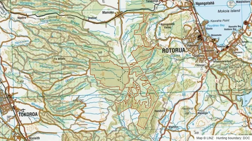
Horohoro Forest is a large 5,417-hectare public hunting block in the Rotorua Lakes country. The block is lowland and foothill country, topping out at 844 m.
Elevations run from 361 m at the lower edges to 844 m at the high point, with a median of 612 m. All of the block sits below the bushline. Slopes lean north-west-facing on the whole.
Listed game is red deer, fallow deer, wild goat and wild pig. At this size, there is plenty of country to spread out into; expect to put time into reading the wind through the bush blocks.
Open Horohoro Forest on the interactive map
Boundary, huts, terrain, tracks and 1080 zones — all layers, one map.
Terrain & elevation
Based on a sample of 15,013 DEM points inside the block.
- Elevation range
- 361–844 m
- Median elevation
- 612 m
- Middle 50%
- 558–652 m
- Above bushline (1,200 m)
- 0%
- Alpine (1,500 m+)
- 0%
- Dominant aspect
- north-west-facing
361–844 m, lowland / foothill country, leaning north-west-facing.
What you can hunt here
Access & getting there
Helicopter access is not permitted, so hunting on the block is foot-based. WARO is not permitted on this block, which tends to keep it quieter than country open to commercial heli operations.
No DOC huts or campsites are recorded inside the block, so plan on day trips from a vehicle access point.
Permits & rules
You need a DOC hunting permit to hunt this block. It is classed as a Ordinary block in the Rotorua Lakes and surrounds permit area, with a hunting status of Permitted.
A DOC hunting permit is required for the Rotorua Lakes and surrounds permit area. This is an Ordinary block with Permitted hunt status, issued on a free, non-ballot basis. Carry your permit while hunting.
1080 & pesticide status
No laid, planned or proposed pesticide operations intersected this block in our data. Always confirm with DOC before taking a dog in.
Data snapshot: 26 May 2026 — always reconfirm with DOC before relying on this.
Get roar & 1080 alerts for the areas you hunt
We'll email you when pesticide operations, ballot dates or access conditions change for Waikato.
Sign up →