Waikaia Forest
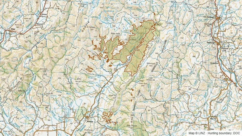
Waikaia Forest is a 10,173-hectare hunting block in Southland. Elevations run from about 214 m to 1,009 m, with a median around 500 m.
The country here is mostly bush country with a tops fringe, with slopes that lean south.
The block carries red deer. It is a designated Roar block, so access is managed during the rut.
Open Waikaia Forest on the interactive map
Boundary, huts, terrain, tracks and 1080 zones — all layers, one map.
Terrain & elevation
Based on a sample of 34,640 DEM points inside the block.
- Elevation range
- 214–1,009 m
- Median elevation
- 500 m
- Middle 50%
- 383–663 m
- Above bushline (1,200 m)
- 0%
- Alpine (1,500 m+)
- 0%
- Dominant aspect
- south-facing
214–1,009 m, foothill country with low tops, leaning south-facing.
What you can hunt here
This is a roar — the red deer roar peaks from late March into April, and competition for the block is highest then.
Access & getting there
Air access is permitted on this block, useful for cutting a long valley approach. WARO is not flagged for the block.
No DOC huts or campsites are recorded inside the block, so trips here are typically fly-camp or based out of facilities in adjoining country.
Permits & rules
You need a DOC hunting permit to hunt this block. It is classed as a Roar block in the Southland Hunting Areas permit area, with a hunting status of Permitted.
This block sits within a DOC air-access zone — fly-in hunting and helicopter drop-offs may be permitted.
A DOC hunting permit is required to hunt Waikaia Forest. The block is a Permitted Roar block under the Southland Hunting Areas permit area, so access during the rut may be managed — check current conditions with DOC before you go.
1080 & pesticide status
No laid, planned or proposed pesticide operations intersected this block in our data. Always confirm with DOC before taking a dog in.
Data snapshot: 26 May 2026 — always reconfirm with DOC before relying on this.
Get roar & 1080 alerts for the areas you hunt
We'll email you when pesticide operations, ballot dates or access conditions change for Southland.
Sign up →